Swiss engineering operations room with radar maps and data dashboards on a screen wall

Ready to use · hosted in Switzerland

Ready-to-use tools for industry, technical operations and institutions

Nine proven software building blocks we put into operation on your data within days — hosted in Switzerland, carrying your branding and handed over to your team with full documentation.

01 · Earth observation

SAR change monitor

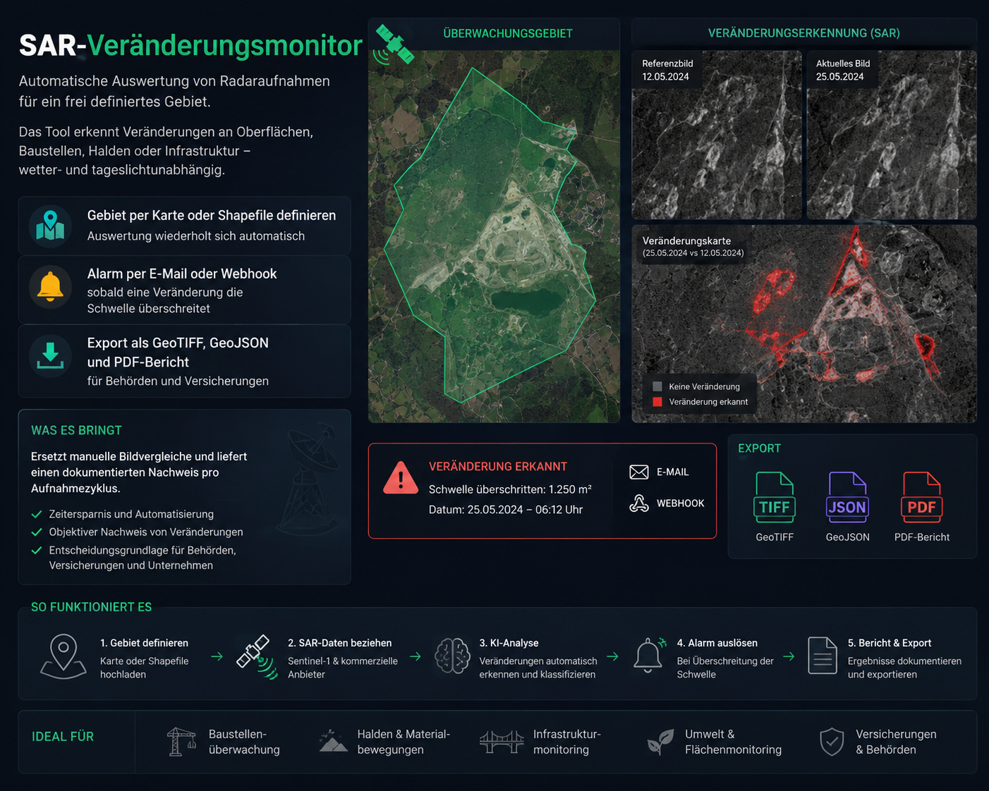
SAR change monitor: monitored area, reference and current imagery, change map with alerting and GeoTIFF, GeoJSON and PDF export

Detect change before it becomes a problem. The SAR change monitor automatically watches defined areas using radar satellite data (SAR, Sentinel-1 and commercial providers) and detects relevant changes to terrain, construction sites, landfills, material stockpiles and critical infrastructure — regardless of cloud cover, weather or daylight. Areas are defined on the map or via shapefile; every new acquisition is compared automatically against previous data. When the system detects a relevant change, it is located, assessed and documented. Automatic alerts by email or webhook notify the responsible team as soon as defined thresholds are exceeded. Results and change evidence can be exported as GeoTIFF, GeoJSON or a PDF report. Ideal for authorities, municipalities, insurers, construction companies, infrastructure operators, utilities and environmental monitoring.

  • Define the area on a map or by shapefile; analysis repeats automatically with every new acquisition
  • Automatic comparison of reference and current imagery, with each change located and assessed
  • Alerts by email or webhook as soon as a defined threshold is exceeded
  • Change map with classified areas plus the date and size of the detected change
  • Export to GeoTIFF, GeoJSON and PDF report for authorities, insurers and project owners
  • Historical evidence for every monitoring cycle, in any weather and at any time of day

What it delivers

Manual inspection becomes continuous monitoring from space: fewer site visits, earlier detection of critical change and a traceable historical record for every monitoring cycle.
Request this tool
02 · Geodata

Geodata Cockpit – visualise and use all geodata in one place

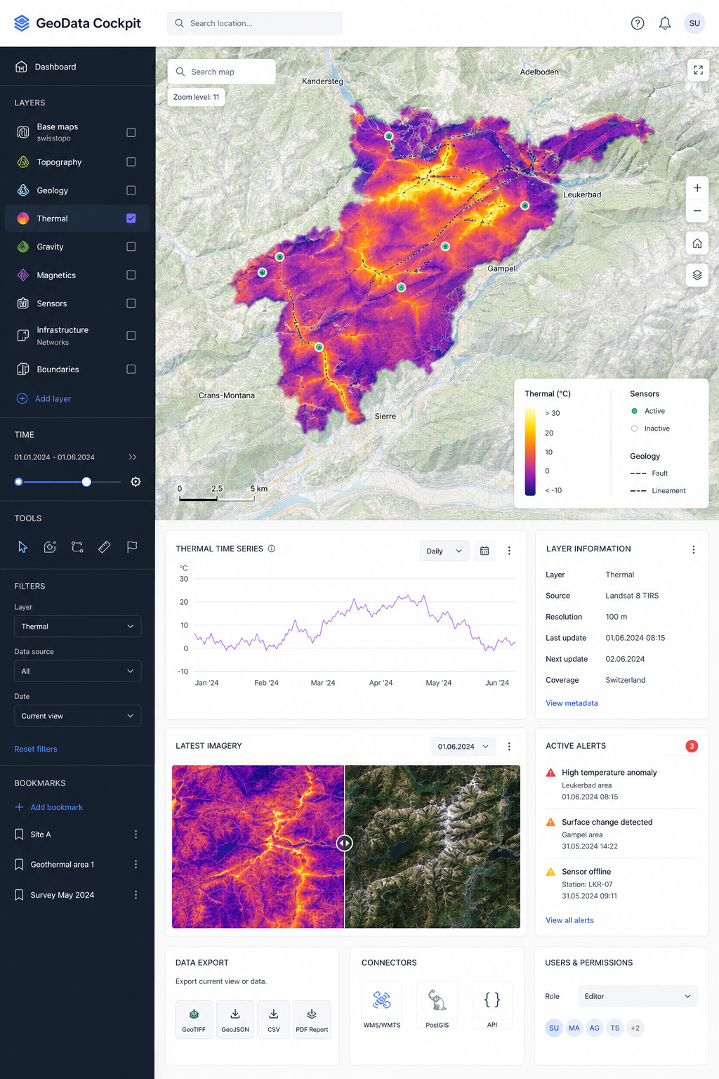
Geodata Cockpit: Swiss map portal with swisstopo base maps, thermal layer, time series, sensor alerts and GeoTIFF, GeoJSON, CSV and PDF export

All geodata, all systems, one central map. Geodata Cockpit connects swisstopo maps, your own geodata, sensor information and operational systems in a fast, web-based map portal. Different data sources are merged into clear layers and can be used and analysed without classic GIS software. Vector tiles, time series, filters, measurement tools and layer management let you investigate spatial and historical developments directly on the map – from thermal, geology and gravity layers to sensor, infrastructure and boundary data. Individual user and group permissions let you run public map views and protected internal areas at the same time. With interfaces to WMS/WMTS, PostGIS and existing enterprise systems, the cockpit becomes the central geographic information platform. Ideal for municipalities, cantons, energy utilities, infrastructure operators, industry, real estate, environmental work and engineering.

  • Swisstopo base maps, your own domain data and sensor data as switchable layers in one view
  • Vector tiles for fast rendering of large datasets, including on mobile devices
  • Time slider and time-series charts for the development of measurements and areas
  • Measuring, drawing and filter tools plus bookmarks for recurring analyses
  • User and group permissions: public map portals and protected internal areas in one instance
  • Alerts for anomalies, offline sensors and detected changes
  • Export as GeoTIFF, GeoJSON, CSV and PDF report, plus WMS/WMTS, PostGIS and API connectivity

What it delivers

One shared, up-to-date data basis for operations, engineering and management – without desktop GIS licences and without GIS expertise.

Request this tool
03 · Industry & facility management

Predictive maintenance – AI-driven asset and facility management

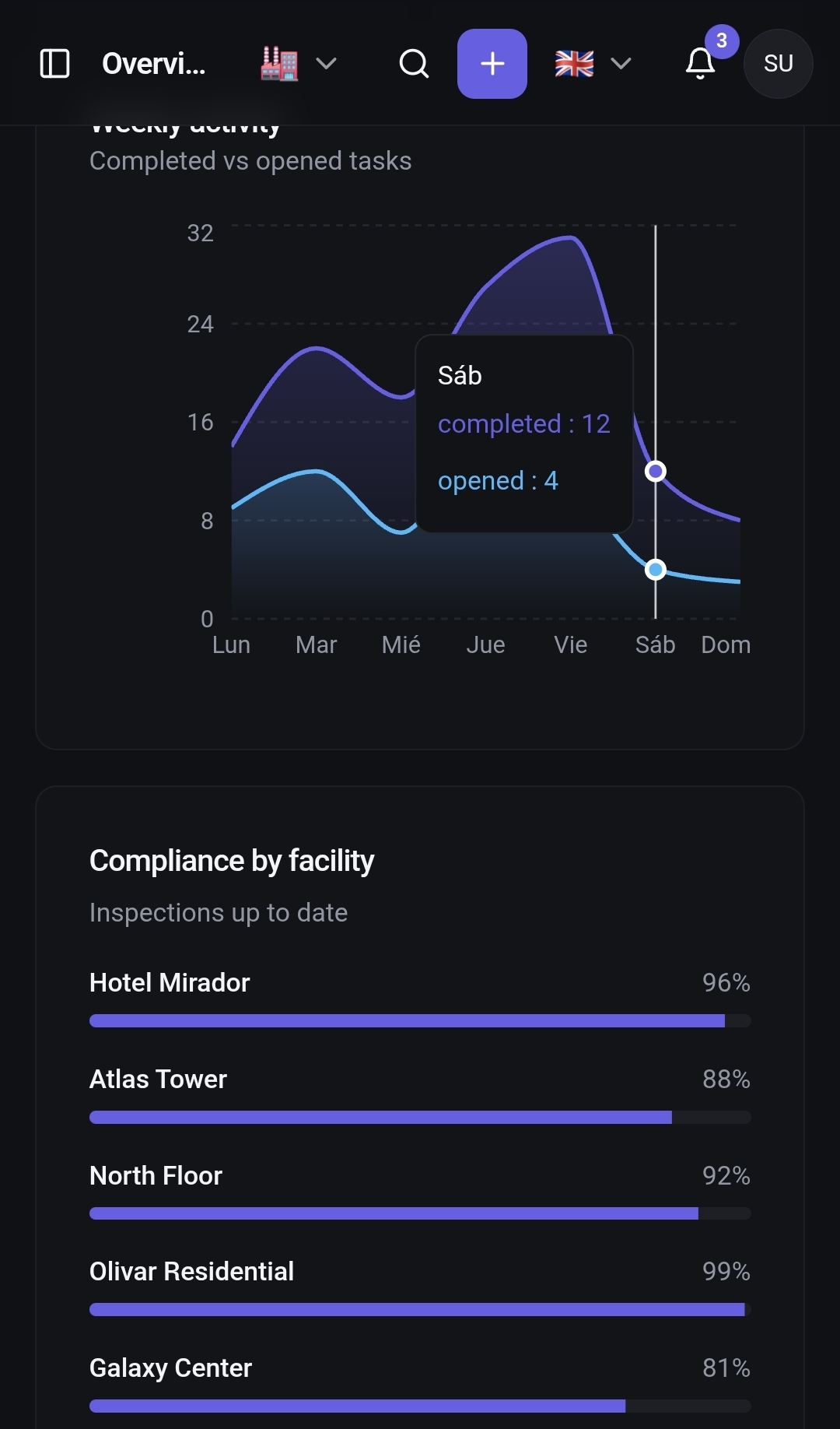
Predictive maintenance dashboard with completed and open tasks per week and inspections per asset

Monitor assets, detect failures early, plan maintenance intelligently. The platform combines predictive maintenance, asset management and AI to supervise buildings, technical installations and infrastructure from one place and to steer maintenance processes efficiently. Machines and building services connect over OPC-UA, MQTT, BACnet or your existing control systems; the AI analyses asset condition, inspections, maintenance history and operating data, spots anomalies and potential risks early, and supports planning the next measures. Automatic alerts, task management, staff and technician scheduling and compliance monitoring make sure the people in charge always know which asset needs attention, why, and what action comes next. Ideal for industry, facility management, real estate portfolios, energy utilities, municipalities and operators of technical infrastructure.

  • AI analysis of asset condition, inspections, maintenance history and operating data with risk and priority scoring
  • Early warning and automatic alerts before an anomaly turns into downtime
  • Task, staff and technician scheduling with owners, deadlines and mobile capture on site
  • Compliance and inspection tracking with evidence, test intervals and audit-proof documentation
  • Asset and site structure for entire portfolios: buildings, technical installations, infrastructure and spare parts
  • Edge pre-processing; works without a permanent cloud connection
  • Interfaces to SAP PM, Odoo, ERP, CAFM and common ticketing systems

What it delivers

From reactive repairs to intelligent, forward-looking asset management: less unplanned downtime, plannable interventions and provable compliance per asset.

Request this tool
04 · AI

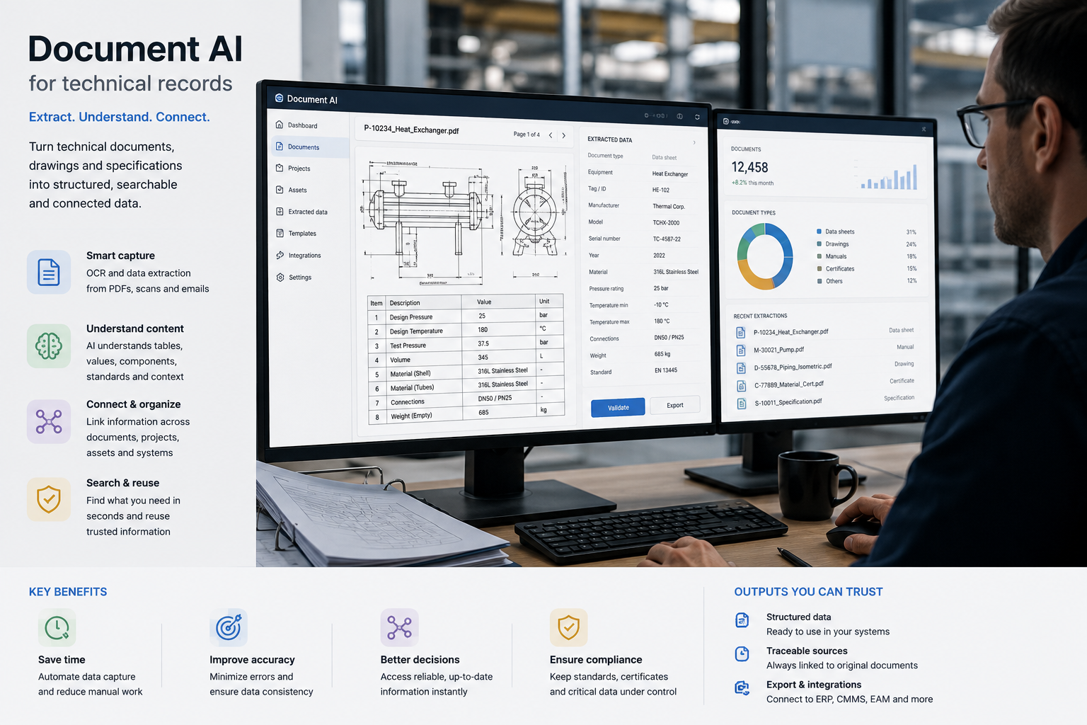
Document AI for technical records

A searchable knowledge base over standards, specifications, test reports and contracts. Every answer cites its source, and the documents never leave your environment.

  • Multilingual search across DE/FR/IT/EN in one corpus
  • Answers with source, page reference and confidence score
  • Runs in a Swiss data centre or fully on-premise

What it delivers

Research time inside technical dossiers drops from hours to minutes.

Request this tool
05 · Portfolio

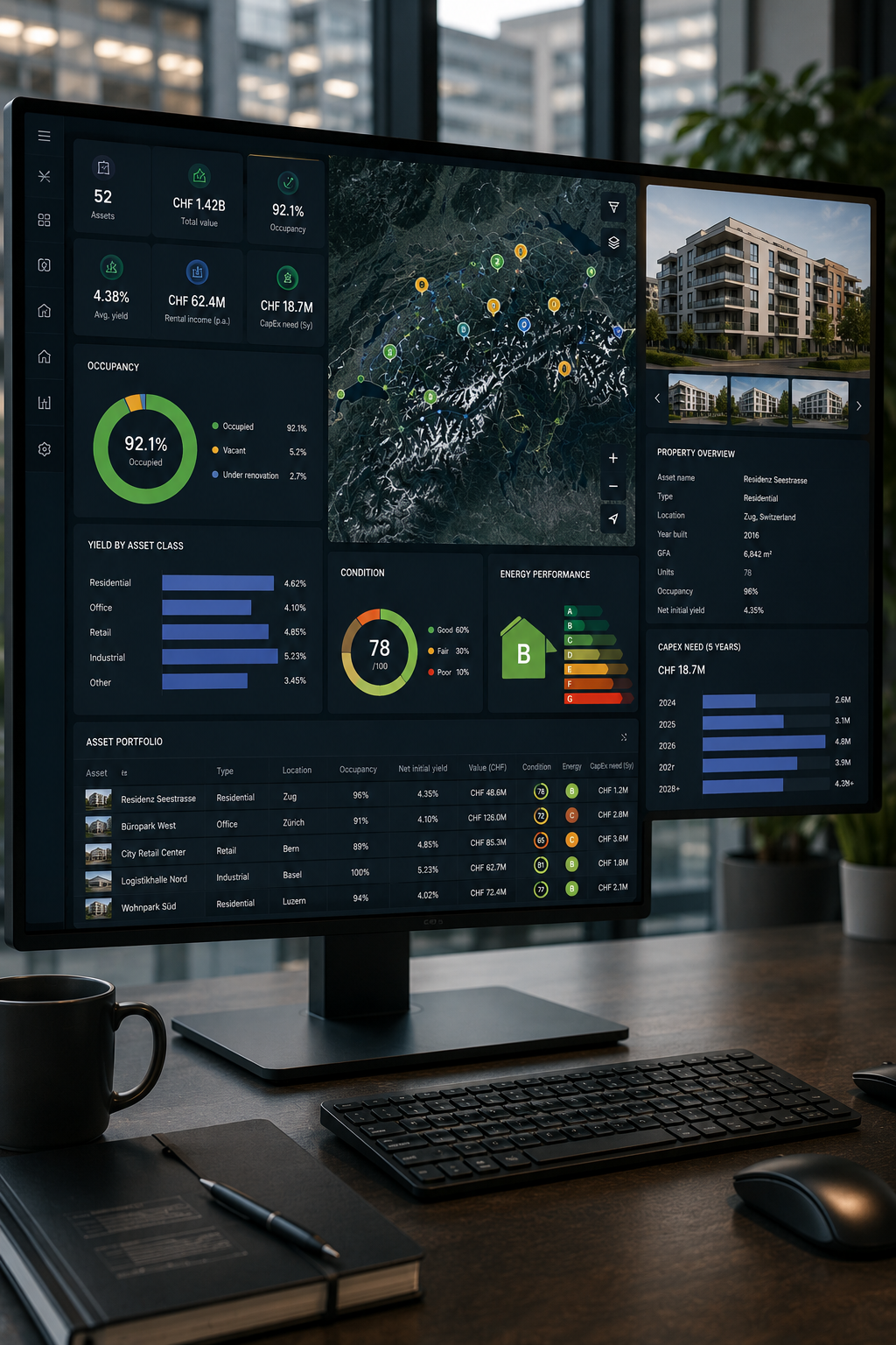
Portfolio and property cockpit

Metrics, maps and scenarios for real-estate or asset portfolios: occupancy, yield, condition, energy figures and investment needs in a single view.

  • Import from Excel, ERP or an existing property management system
  • Scenarios for refurbishment, disposal and yield development
  • Automatic quarterly PDF reports for the board or the authority

What it delivers

One reliable state of record instead of twelve spreadsheets with different dates.

Request this tool
06 · Forecasting

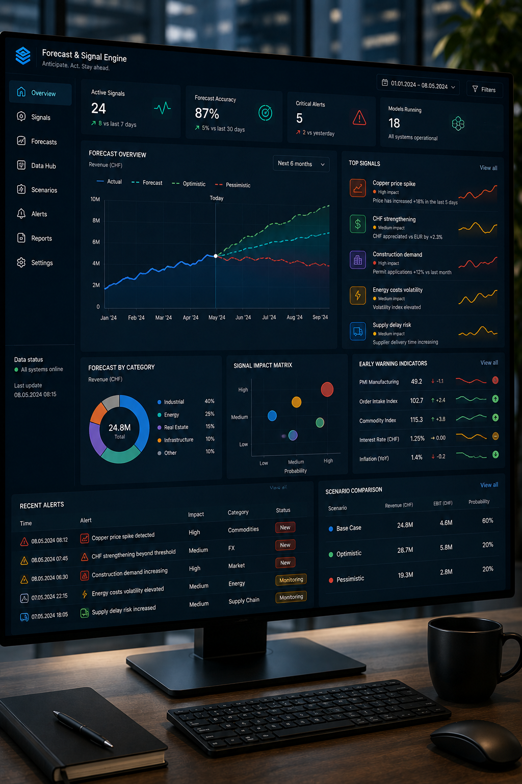
Forecast and signal engine

Time-series forecasts for consumption, load, prices or demand, including backtesting, confidence bands and an API your existing systems can query.

  • Backtesting with traceable quality metrics before go-live
  • Signals via API, webhook or directly in the dashboard
  • Drift monitoring with rollback to the last stable model

What it delivers

Planning figures are produced automatically and stay defensible in an audit.

Request this tool
07 · Public procurement

AI tender radar Switzerland

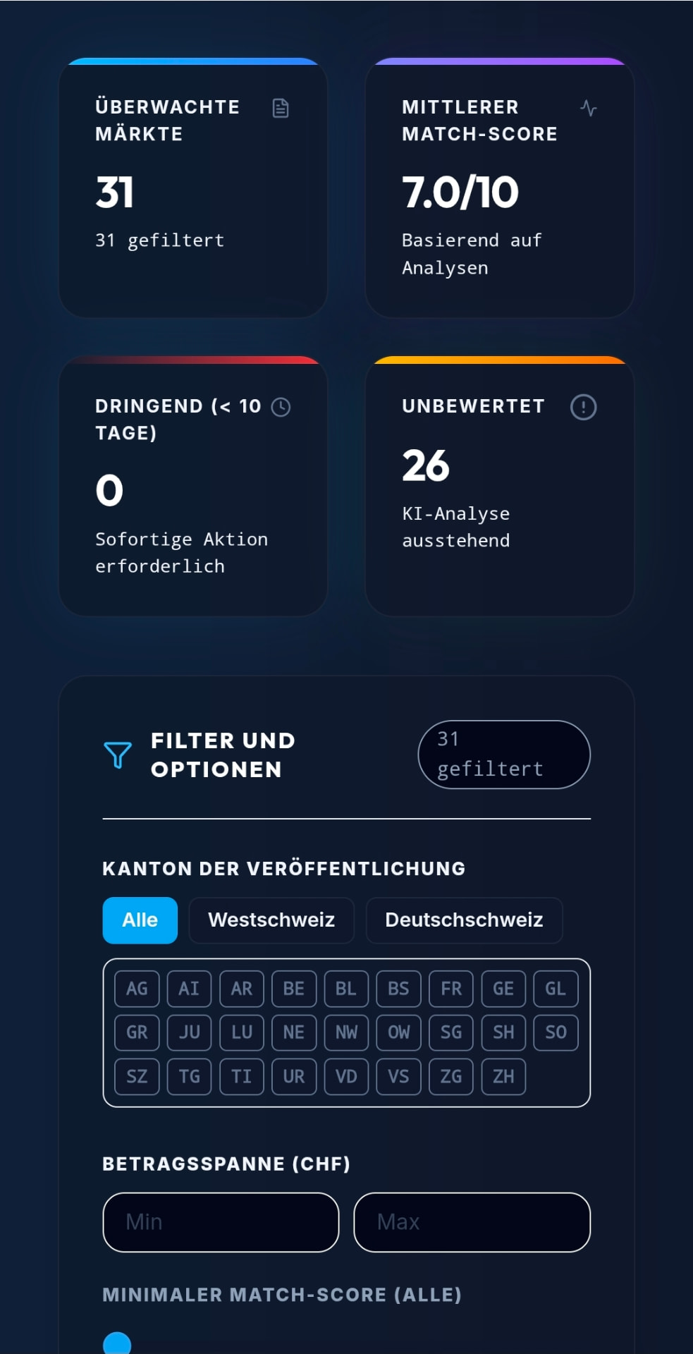
AI tender radar dashboard showing Swiss SIMAP tenders, AI match score and submission deadlines

Find public tenders, spot opportunities, win contracts. Our AI continuously analyses Swiss public tenders, submissions and awards — from SIMAP, cantonal and communal portals, official gazettes and award notices — and automatically identifies the projects with the highest potential for your company. Instead of reading hundreds of publications every week, your team receives a ranked shortlist that matches your services, references, regions and capacity. Every tender is scored, summarised and enriched with the requirements, eligibility criteria, submission deadlines and contact points that decide whether a bid is worth preparing. Beyond published tenders, the platform reads market and procurement signals — budget decisions, planning permissions, framework agreements about to expire, recurring award patterns of a given authority — so you can position yourself with the decision makers months before the official publication. Past awards are analysed as well: who won, at which price level, with which consortium, and how often an incumbent is replaced. From market opportunity to award, everything stays in one workspace with a full audit trail.

  • AI match score per tender, based on your services, references, regions, languages and capacity
  • Automatic summary of scope, eligibility and award criteria, required certificates, lots and deadlines
  • Coverage of SIMAP plus cantonal, communal and specialist procurement sources in DE, FR, IT and EN
  • Early market signals from budgets, planning decisions and expiring framework agreements
  • Competitor and award history: who won, at what price level, and how contestable the incumbent is
  • Deadline and task management for the bid team, with owners, reminders and document checklist
  • Alerts by email, dashboard, Teams or API, plus CSV and CRM export for your sales pipeline

What it delivers

From market opportunity to award: AI-driven intelligence for Swiss public procurement — fewer missed deadlines, better bid/no-bid decisions and a measurably higher win rate.

Request this tool
08 · Sales & CRM

GeoCRM – customer management on the map

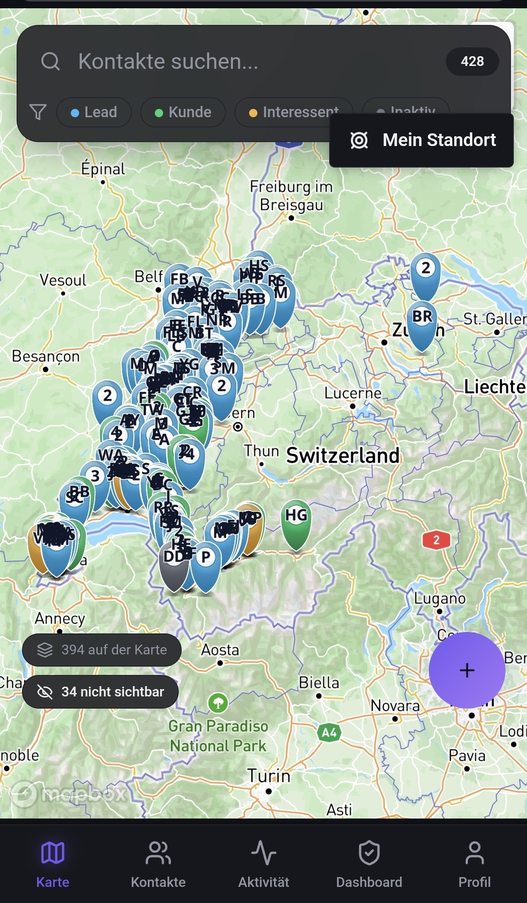
GeoCRM map of Switzerland with customer contacts, contact-type filters and location search for visit planning

Locate customers, manage contacts, develop sales opportunities. GeoCRM combines CRM, geolocation and sales management in one platform: customers, leads and prospects appear directly on an interactive map, linked to all relevant contact, company and activity data. New contacts are captured automatically with a business-card scan and merged into the database; visit reports, notes and activities attach straight to the contact. With navigation, reminders, alerts and next-step planning, GeoCRM supports the whole sales process — from first contact to the customer visit and the next sales action. A Swiss CRM that does not only store contacts, but shows where your customers are and what to do next.

  • Customers, leads and prospects on the map, filtered by type, status, region, industry and potential
  • Business-card scanner: photograph the card, extract the data, keep the database duplicate-free
  • Visit planning and routing for field sales, including navigation to the next customer visit
  • Visit reports, notes, quotes and activities attached to the contact and the company
  • Reminders, alerts and next-step planning so no follow-up is forgotten
  • Offline-capable mobile use with sync as soon as connectivity returns
  • Interfaces to email, calendar, ERP and existing CRM or sales systems

What it delivers

Field sales instantly sees which customers are nearby, what was last discussed and what comes next — more customer visits per day and fewer lost opportunities.

Request this tool
09 · Surveying & construction

MetriFusion – intelligent building and area surveying in Switzerland

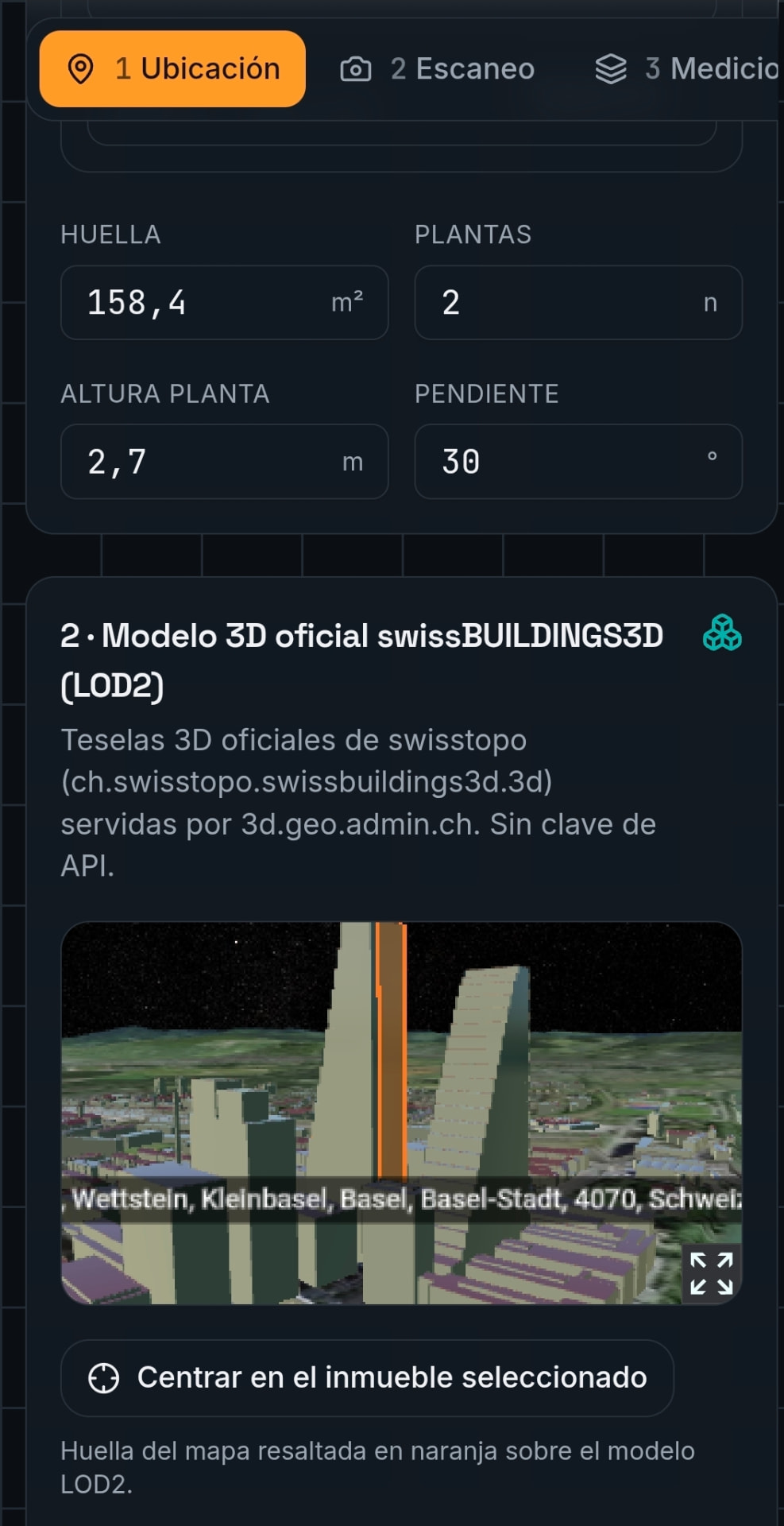
MetriFusion interface with a 3D building model (swissBUILDINGS3D, LOD2) and computed façade, roof and volume values

Locate buildings, measure areas, calculate volumes — digitally, on site or remotely. MetriFusion combines geodata, 3D building models (swissBUILDINGS3D, swisstopo, LOD2) and intelligent surveying to locate and analyse buildings and parcels across Switzerland. Even without a site visit you can derive the building footprint, the parcel, façade areas, roof areas, building height and volume, and use them for early planning, cost estimates and project appraisals. For more detailed capture, MetriFusion also supports scanning directly on site: the system recognises the selected building or parcel and automates the capture and calculation of the relevant dimensions, from a single surface to the entire building. Ideal for construction firms, general contractors, architects, roofers, property developers, investors, communes and cantonal offices.

  • Locate buildings and parcels anywhere in Switzerland by address, parcel number or map
  • Calculate façade area, roof area, building height and volume from 3D models
  • Digital pre-survey without a site visit for quotations and cost calculations
  • On-site scan with automatic building recognition and per-surface measurement
  • Based on swissBUILDINGS3D, swisstopo data and official cadastral surveying
  • Export as PDF measurement report, DXF and GeoJSON, with handover to CAD, BIM or ERP
  • Multi-user operation for contractors, architects, communes and cantonal offices

What it delivers

From an address to a digital building survey — faster, more efficient and with far less on-site effort.

Request this tool

Operations, data and handover

  • Data hosted in Switzerland or the EU, fully on-premise on request
  • A dedicated instance per client, no shared data pools
  • Go-live typically within ten working days
  • Handover pack with runbook, training and a source-code option

Frequently asked questions

How quickly can a tool go live?

From first data access, expect five to ten working days to a productive instance, followed by tuning and training.

Where is our data stored?

By default in a Swiss data centre. On request in the EU or inside your own infrastructure.

Can the tools be customised?

Yes. Each tool is a product core we extend with your fields, rules, interfaces and branding.

Which tool fits your situation?

Describe your data and your goal in a few lines. Within two working days you receive an assessment with effort, running costs and a schedule.

Describe your project